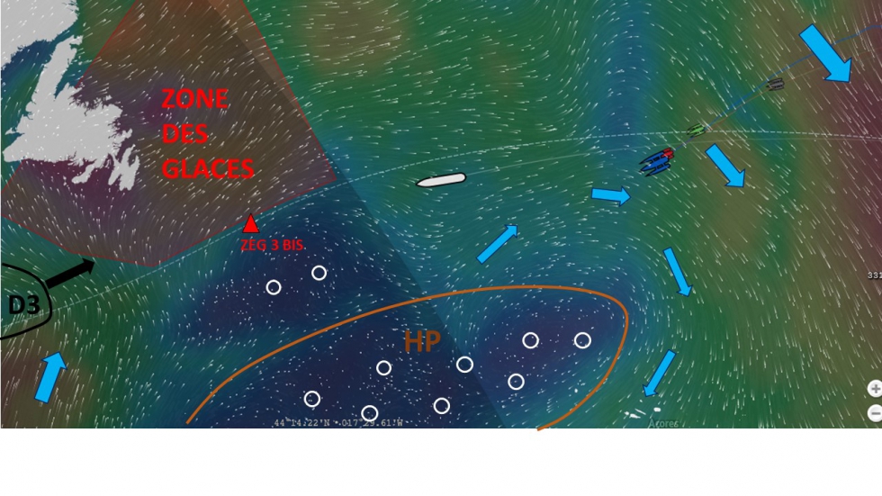
After having made the best use of the best Irish depression reaching speeds of 30 knots in winds from North - West, multihulls (red circles) are being slowed down again. They face a new difficulty: tack in a corridor of barely 200 miles wide, bounded on the South by HP (high pressure) of the anticyclone of the Azores (Brown line) and to the North by the ice Zone which has been enlarged yesterday (ZEG 3 BIS).
Between ice and fog
A great tactical skill to sneak between the small quiet areas will be needed, as well as, respecting the constraints of the Ice Exclusion Zone and anticipating the arrival of the D3 depression arriving from the West.
While 2000 miles north-northwest are remaining, nothing is played yet between the top three who are expected to arrive in New York on the morning of Monday... …

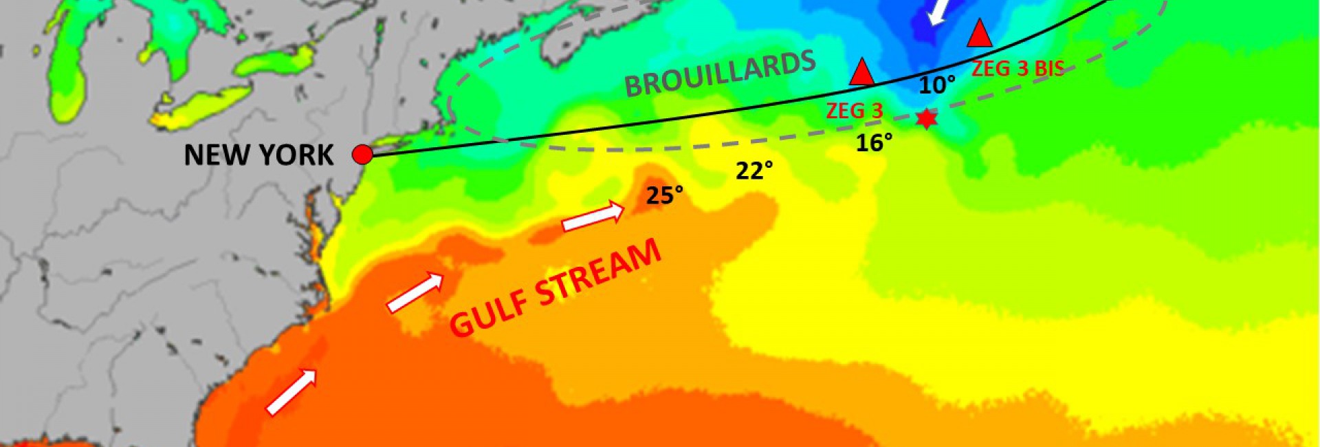
The whole fleet, including Queen Mary 2, is entering a very specific area. It is the most frontal encounter between the Labrador current 2° waters that push to the South the icebergs from Northern Canada, and the warm waters of the Gulf Stream going all the way back to the Mexico Gulf.
Thermal shock is unique in the world. It is at the origin of several specific phenomena
- In water : The proliferation of marine animals and in particular cetaceans who love this hot - cold mixture and that sailors will have to try to avoid.
- At the air - water interface : The creation of fog makes navigation a dangerous area full of fishermen.
- In the air : The nursery to depressions in the North Atlantic, which also nurture this contrast and gives birth to the sometimes violent phenomena that will cross the Atlantic until reaching us.
A good dose of lucidity and know-how will be required for sailors to get out unharmed - and if possible winners! -of this North Road which had been fatal to (Red Star) Titanic in April 1912 and that we will "flyover" in the afternoon.
Safe journey !
Dominic Vittet